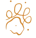
A year after collaring two hyena in a snaring hotspot next to the Kruger National Park, the GPS data has delivered crucial insight into wildlife movements both within and outside the reserve. Research from Kenya has shown that a desnaring strategy that balances visits to known snare poaching hotspots with efforts to identify other hotspots is more effective than a sequential site-by-site approach. One way to identify snaring hotspots and incidences is by mapping wildlife movement with GPS collar data. Especially in areas where there is less tourism activity and hence less potential for sightings of snared animals, having GPS data is important.
The map shows how, while generally true to their home range, hyena can roam over significant distances in the time space of a month (In this case, Aug-Sept 2025). The distance covered will vary between seasons, the age and gender of the collared individual, as well as whether the clan is denning or not. The data helps reserve management to understand where hyena spend most of their time. This helps guide patrol routes and frequency. This particular reserve has had severe snaring impact, due to its proximity to neighbouring community lands. Hyena are often trapped in poachers' snares, and are one of the primary species we get rescue calls for. They regularly move in and out of the reserve, and can be considered an indicator species for high snaring zones.
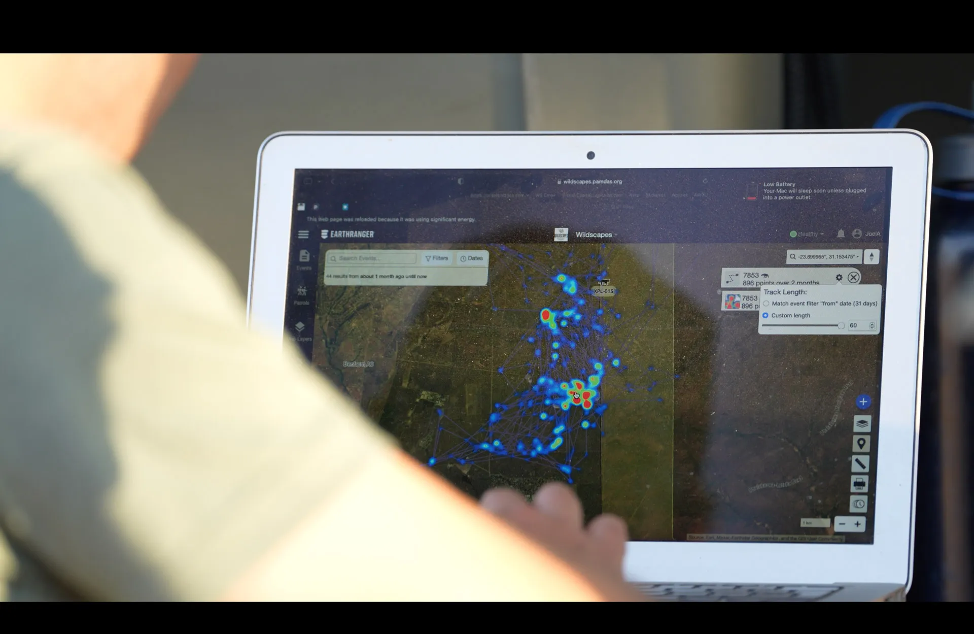
We are proud to have contributed two collars to this monitoring project, and are happy to report that we've received less requests to fund desnaring operations in this area. You can make a difference too! USD3,100 will protect a whole clan of hyena (which can have up to 100 individuals). Click here if you would like to donate to support predator monitoring work.

.webp)